ark ArjunRole of Open Data in the Geospatial WorldWhy do I need to contribute to open data? Why should I share my data with everyone, which I created with my money, time and resources ?Apr 17Apr 17
ark ArjunA Cartographer’s Lament; The Taj Mahal StoryThis article is about the vandalism on map. First published on arkives.in by the same author. License: This article is licensed under the…Jul 6, 2023Jul 6, 2023
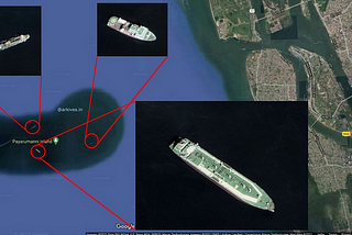
ark ArjunGoogle Maps, the Odiyan of Kochi!In last June (2021), there rose a mysterious island in Kochi. No No No..this is not a fantasy story I am going to narrate, the artefact…Oct 18, 2022Oct 18, 2022
ark ArjunMobile GISLocation intelligence is the new buzzword in the industry. What gave new intelligence to location science? What triggered the recent boom…May 1, 2022May 1, 2022
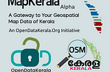
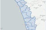
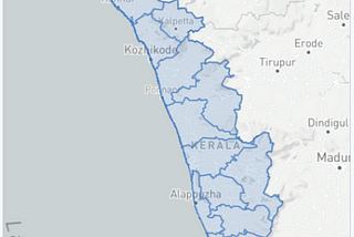
ark ArjunMap Kerala (alpha release)A Gateway to all Your Geospatial Datasets of Kerala, an initiative by Open Data KeralaNov 1, 20211Nov 1, 20211
ark ArjunOSM Kerala — The past, present, and future.This article was originally published in HOT blog by the same author along with co authors Manoj Karingamadathil and Awantika PalAug 31, 2021Aug 31, 2021
ark ArjunInstalling the Geospatial Data Abstraction Library (GDAL) in Python and AnacondaInstallation guide and tutorial to install GDAL python library in Windows systemAug 3, 2021Aug 3, 2021
ark ArjunNingalku Map Illa- The MaphuntThis article was originally posted in arkives.in by same author നിങ്ങൾക്ക്മാപ്പ്ഇല്ല (Read as Ningalku Map Illa) is the hashtag I started…Jul 7, 2021Jul 7, 2021
ark ArjunAnswering the unanswered; Answers to unanswered questions of the mysterious Kochi islandThis is a FAQ and their answers, which I received during this period from many people including media in connection with the article, I had…Jun 27, 20212Jun 27, 20212